 Filter: Categories of Wisconsin Historical Images
Filter: FORMAT_DIMENSIONS of 45 x 41 cm
Filter: Categories of Wisconsin Historical Images
Filter: FORMAT_DIMENSIONS of 45 x 41 cm

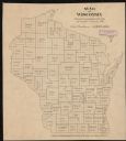
| Date: | 1887 |
|---|---|
| Description: | This 1887 map of Ashland County, Wisconsin, shows the township and range system, sections, railroads, vacant Wisconsin Central Railroad land, state and "go... |
| Date: | 1836 |
|---|---|
| Description: | This plat map shows the proposed Town of Whitesboro, a paper city (a city planned but never built), located on the Manitowoc River in Calumet County. Certi... |
| Date: | 1895 |
|---|---|
| Description: | This map shows the populations for each county in accordance with the census of 1895. The original captions read, " Total population-1,937,915. Diagram sho... |
If you didn't find the material you searched for, our Library Reference Staff can help.
Call our reference desk at 608-264-6535 or email us at: